

“I don’t think we’ll ever be back.” Victor Doerksen (age 65), September 26, 2019
We completed our John Muir Trail hike on Sept 26, 2019 at Tuolumne Meadows. We had been on the trail for 19 hiking days and had finished the journey we had set out to accomplish. It all hits when you stop: muscles begin to seize up; you feel dirty, ugly, smelly and unkempt; tiredness gets the best of you; you just want out. We were done … we had done it … we were completely satisfied … we had been on a journey that very few people on earth get to make … we were both 65 … it’s not likely that we will ever do this trail again … there are lots of other places on earth to see.
Never Say Never: It’s now 6 months since we completed our hike and I think I would like to hike the JMT again … crazy eh? It would be especially fun to see it through another first timers eyes and experience it all over again.
In the meantime …. this post, and the next two, are mainly about our itinerary. I found it very helpful to read about other hikers experiences and plans and I studied their itineraries in detail as I planned our own. There are far fewer itinerary’s for those going south to north … so, maybe this will help you.
Our Basic Plan:
- South to North.
- Cottonwood Meadows, via Cottonwood Pass to Tuolumne Meadows.
- Mount Whitney was not in our plans.
- Sept 7, 2019 to Sept 26, 2019.
- 2 Resupply points.
Section 1: Cottonwood Meadows to Onion Valley Trail head.
Day 1 (Sept 7, 2019): Cottonwood Meadows via Cottonwood Pass (11,160 feet) to Chicken Spring Lake (11242 feet). 4.5 miles.
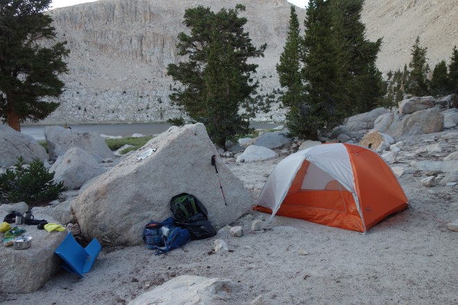
Our original plan was to get our permits on Sept 7 and camp at Cottonwood Meadows to acclimatize and hike to Rock Creek on the 8th (the reserved dates for starting our hike). When we checked in for our passes we were able to move up our reservation to Sept 7th so we opted to knock off 4 miles that afternoon and head to Chicken Spring Lake. The hike to Chicken Spring Lake was relatively easy and we had no difficulty getting there in good time. Camping spots were plentiful and very pretty …. one of our nicer campgrounds.
Altitude Sickness: The only problem with starting on the south end is that you start immediately at high elevation and without acclimatization altitude sickness becomes a factor to consider. It got to Doris and made her first night (which was complicated by a severe windstorm during the night) and the next couple days pretty miserable. Fortunately, the next two campgrounds were at least a 1000 feet lower than Chicken Spring Lake and she improved … but for a few days we did consider the wisdom of carrying on.
Day 2 (Sept 8, 2019): Chicken Spring Lake via Siberian Pass (10,900 feet) to Rock Creek (9820 feet). 8.5 miles.
A beautiful day and a lovely hike, marred only by the fact that Doris was miserable. Rock Creek was a decent enough campground with lots of space to set up.
Day 3 (Sept 9, 2019): Rock Creek via Guyot Pass (10,900 feet) to Crabtree Meadow (10,320 feet). 7.0 miles.
Another stunning, cloudless day (a recurring theme on our first Leg). Crabtree Meadow was another pretty campground and we watched the deer laze in the meadows. A great day of recovery for Doris … nice to see her smile return.
Day 4 (Sept 10, 2019): Crabtree Meadow via Bighorn Meadow to Tyndall Creek (10,920). 7.5 miles.
Bighorn Plateau was one of my favorite sections of the trail … as a Prairie boy I grew up being able to see unobstructed, save for a few grain elevators, from horizon to horizon … that’s what we got on the Bighorn Plateau, all too soon over. 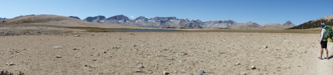
Tyndall Creek was a decent campground with a very pretty creek over hard rock. A good place to stop before the assault on Forester Pass.
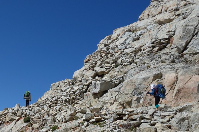
Day 5 (Sept 11, 2019): Tyndall Creek via Forester Pass (13,153 feet) to Lower Vidette Meadow (9540 feet). 9 miles.
Much ado is made about the climb up to Forester Pass, but we have frequently hiked the Rockies in Canada and have had more “exposure” on those trails than the path up to Forester Pass. Nevertheless, I would not wish to be exposed on the climb up Forester Pass in inclement weather, nor before the snow-pack has melted …. mountain passes anywhere in the world can be dangerous places. We were blessed with a spectacular day, spectacular scenery, and great hiking partners. It doesn’t get much better than that.
Lower Vidette Meadow was unremarkable with lots of camping options. We hiked past nicer campgrounds than the one we stayed at but we were setting ourselves up for our resupply day in Independence.
Day 6 (Sept 12, 2019): Lower Vidette Meadow via Kearsarge Pass (11,835 feet) to Onion Valley Trailhead (9185 feet). 8.0 miles.
I spent a lot of time agonizing about using Independence as a resupply point since it’s a 7 mile detour off of the JMT. In the end, the logistics of parting company with our son who could only hike with us for week made it a no-brainer.
I need not have spent all that time agonizing over that decision … the hike past Bullfrog Lake, Kearsarge Lakes, along with the climb up and over Kearsarge Pass and down to Onion Valley Trailhead were among the most beautiful we would encounter on the JMT. It remains as one of my favorite memories. Probably helped that the weather again was a perfectly cloudless day.
Day 6 (Sept 12, 2019): Resupply at Mount Williamson Motel, Independence (3930 feet).
We arrived in Independence in early afternoon, enough time to go for burgers at Lone Pine, and repack our gear for our longest stretch before the next resupply point at the Muir Trail Ranch. For the next few days our packs would be at their heaviest … and we had monster passes to climb.
A zero day sounded like a good thing … didn’t happen.
Final Thoughts on Section 1.
Other than the elevation acclimatization going south to north is a great option. We took it pretty easy for this section …. longer distances per day lay ahead … but it was a great way to start our trek. We were blessed with outstanding weather.
Check my earlier posts for additional pictures.
